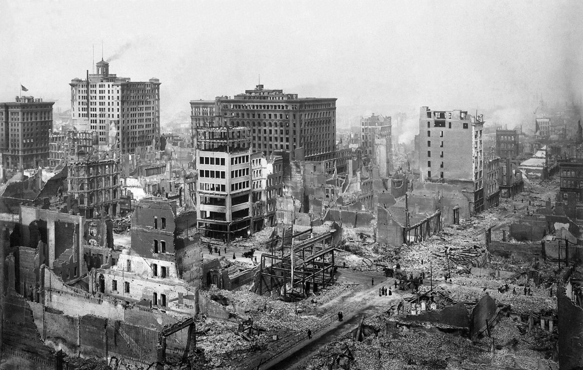
The sun rose as it always does on April 18, 1906. The difference this morning was the reflection of red flames against dense brown clouds that loomed over the city. Roads disheveled, buildings demolished and casualties on the rise — this marked one of the most significant earthquakes in history and one that would be analyzed 120 years later.
While the golden state is known for its hard-to-beat weather and sun tax, the California coast comes with a price: wildfires and seismic instability.
Ever since the 1906 earthquake — a catastrophe that reshaped the state’s understanding of seismic risk — there has been a lingering concern on when the next one might hit. According to the U.S. Geological Survey Earthquake Science Center (USGS), California has more earthquakes that cause damage than anywhere else in the country.
San Francisco has vulnerabilities unique to any other city. It sits on a major active fault line, one being the San Andreas Fault — a massive boundary where two of Earth’s tectonic plates slide past each other. San Francisco is surrounded by a network of faultlines, making the likelihood of the “big one” an ever-pending fear.
While the 1906 earthquake brought devastation, it also opened up new avenues for geologists and engineers to understand the complexities of living and building along active fault lines.
Xpress sat down with Keith Knudsen, deputy director of the USGS and a quaternary geologist and geomorphologist who specializes in the assessment of earthquake hazards. He also served as President of the Earthquake Engineering Research Institute’s Northern California Chapter during the 100 year anniversary of the 1906 earthquake. Local to the Bay Area, Knudsen shared his expertise in seismic safety, earthquake preparedness and how these issues continue to impact communities over a century later.
The following conversation has been edited and condensed for clarity.
- Tell me about yourself, your background and what makes you so passionate about this line of work.
My educational training is as a geologist, and I probably got into that because I liked being outdoors, and I liked the people involved. The last dozen or so years, I worked at the USGS, helping to run the Earthquake Hazards Program. It’s hard not to get behind such a mission: to better understand earthquakes, to get information out, to collect information, synthesize it and try to better understand earthquakes and help people prepare and mitigate against them.
- In 1906, was the city of San Francisco prepared, in any capacity, for an earthquake of that magnitude?
No. Earthquakes were not understood back then very well, at all. And that’s one of the things about the 1906 earthquake … there were a lot of academicians and others who went out and studied the effects of that big earthquake. And a big part of the 1906 earthquake damage was fire related. There used to be fires that got out of control and burned significant parts of cities. That was not an unusual thing, but this was an earthquake that, in part, caused those fires.
- What major lessons were learned from the 1906 earthquake that still influence safety today?
Because of the density of buildings, and the vulnerability of buildings and infrastructure in San Francisco, it’s known as the San Francisco earthquake. That earthquake is known as one that caused abundant fire. And, one of the things I worry about is, as the climate changes, we’re going to have more and more interactions between earthquakes and fires. A big earthquake in California. This April is pretty dry already, right? There’s much more infrastructure, much more opportunity to start fires, for there to be ignitions. And then with climate change, the likelihood of having out-of-control fires following earthquakes is much higher than it used to be.
- How effective are preparations like the Great ShakeOut drill and earthquake supply kits?
Well, we could always do a whole lot better. It’s sort of a never-ending goal to try to educate people about earthquake hazards and about what to do when an earthquake happens. There’s been a lot of outreach: Organizations that try to translate technical scientific information that the public can use; earthquake anniversaries, that we try to capitalize on; programs in schools; and an increasing amount of social science being done around how to message and foster change in people’s behaviors.
- What can San Franciscans do to prepare for earthquakes and natural disasters?
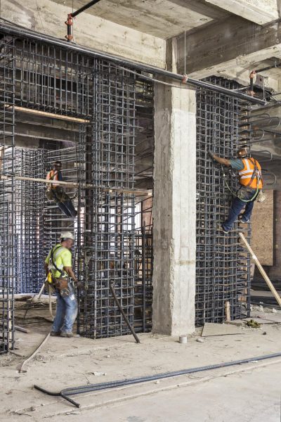
There’s the seven steps to earthquake safety. That’s something a lot of people have grabbed hold of. We worked hard on that. There’s the standard: Have at least three days worth of water for every person — those sorts of things are in lots of publications for the general public. I encourage people to learn about the buildings they spend time in. Are those buildings safe and are they going to collapse during an earthquake? Are they going to hold up? When were they built? Have they been retrofitted? Has anyone ever done an evaluation of them, if they’re old? I’m not sure that that message gets across to people. But I certainly spend time thinking about the buildings I’m spending time in.
- From the start to the finish of your career, what have been the most significant moments that you’ve witnessed?
Well, technology certainly helped. When I started in this field, it would take us weeks to build a reasonable picture of how the shaking occurred across the area. Now we have that information in a minute or two. We have a dense network of sensors in California and the West Coast that communicate information back to computers that process it. …There are times when we can sense that an earthquake is starting and warn people before the intense shaking gets to them. That’s called Earthquake Early Warning. Information from sensors can be synthesized, and then we can send out messages via phone or different systems to alert people. We’re not perfect, but I think with time, both our ability to do that and the applications of that will grow.